


By: Lindsay Cohen
December 22, 2025
As rapid urbanization continues to place new pressures on metropolitan infrastructure, the intersection of spatial design and data analytics has become an increasingly important frontier for urban designers. Zhilin Cai, an urban designer specializing in large-scale urban corridors, has contributed to public-sector projects that aim to integrate mobility, public space, and digital analysis to address complex urban challenges. By combining spatial design with analytical evaluation, his projects have received international recognition for his work in this evolving field.
Most recently, Cai received a London Design Award Gold, a highly regarded distinction within the international design awards program. Organized by the International Awards Associate (IAA), the London Design Awards recognize notable creative excellence across architecture, urban design, and related disciplines, attracting submissions from designers and firms across various countries, including the United States, the United Kingdom, China, Germany, Italy, and many others. Projects are evaluated by an independent panel of industry professionals, with the Gold tier awarded to a select group of projects that demonstrate strong design quality, innovation, and relevance to real-world urban conditions. This latest accolade follows previous honors for Cai’s work from programs such as the MUSE Design Awards and BLT Built Design Awards.
From Traffic Artery to Public Realm
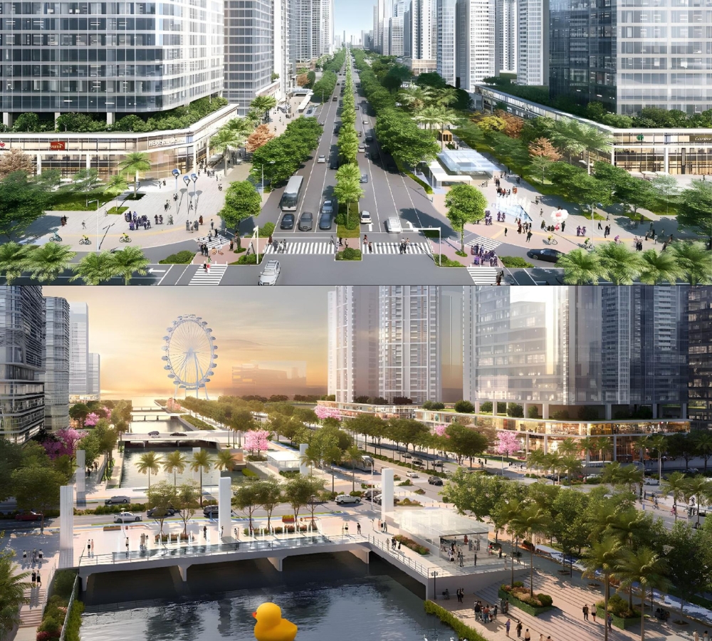
The award was granted for the Shenzhen Xinhu Road Transit Corridor Urban Design Plan, a 6.2-kilometer corridor project located in Bao’an District, one of Shenzhen’s fastest-growing urban areas. As the district’s only north–south secondary arterial, Xinhu Road serves as a critical link between Bao’an Central District and the Qianhai Cooperation Zone. Rapid development along the corridor has placed increasing pressure on mobility systems, public space quality, and neighborhood connectivity.
The project responds to these challenges by reimagining Xinhu Road as a more people-centered transit corridor rather than a vehicle-dominated roadway. The plan positions the corridor as a defining public realm for the emerging urban center, aiming to balance transportation efficiency with walkability, public life, and environmental comfort.
Data-Driven Design Strategy
Cai played a key role in shaping the project’s overall spatial framework and design strategy, integrating digital analysis with urban design decision-making. He led the project’s big-data typological analysis, a defining component of the design process, to evaluate mobility patterns, street vitality, and development potential along the corridor. “The goal was to move beyond unverified assumptions,” Cai noted regarding the design strategy. These data-driven insights informed a corridor-wide approach that responds to real-world urban conditions.
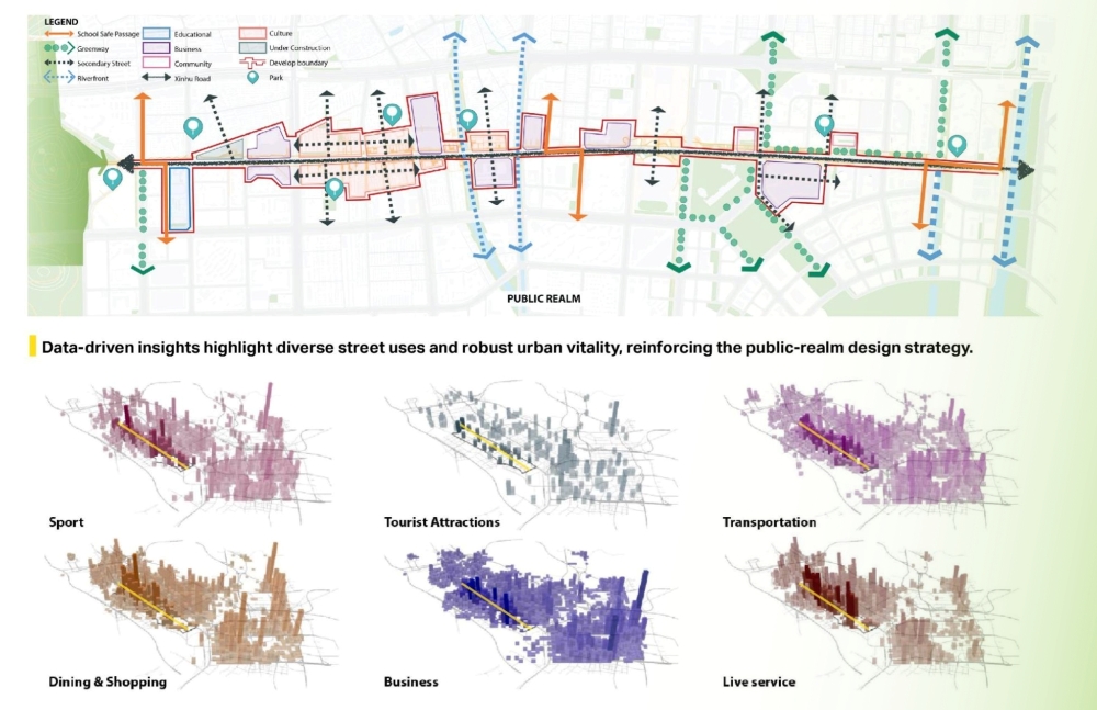
Based on this analysis, the corridor was organized into three thematic segments: Street, Park, and Oasis. The Street segment improves walkability and activates neighborhood street life, enhancing retail visibility and supporting everyday commercial activity both along the corridor and within surrounding inner neighborhoods. The Park segment strengthens multimodal access and establishes a clearer urban arrival, providing a spatial framework to guide potential long-term infrastructure investment and the redevelopment of underutilized parcels. The Oasis segment integrates civic facilities with mixed-use development to create a destination-oriented public realm, positioning the area as a new urban landmark that could attract sustained pedestrian activity and support adjacent commercial uses. Together, these segments form an integrated urban design framework that balances transit efficiency, walkability, and public space quality while allowing design strategies to adapt to varying urban conditions along the corridor.
A Future-Focused Approach
The Shenzhen project reflects a broader design approach that continues to define Cai’s professional focus. In his current work at AECOM, a global infrastructure and urban development consulting firm, Cai plays a key role in projects emphasizing digital workflows, data-driven evaluation, and transit-oriented urban design across the United States. His data-driven visualizations and analytical maps were featured at the Esri User Conference in San Diego, and the digital planning workflow he led for the City of Fort Worth was presented to professional audiences at the American Planning Association Texas Chapter Conference.
As cities increasingly rely on data to guide policy, investment, and infrastructure planning, designers are being asked to interpret complex information in ways that remain accessible to both decision-makers and the public. Cai’s work reflects this shift, using digital analysis not as an end in itself, but as a tool to clarify priorities, communicate spatial implications, and support more informed urban outcomes. Recognition from the London Design Awards not only reflects global recognition but also supports the design path Cai has pursued, where data-driven analysis is used to inform spatial decision-making and long-term urban outcomes. In his ongoing work at AECOM, Cai continues to apply this approach, playing a critical role in advancing data-driven and transit-oriented urban design initiatives across major U.S. cities and international contexts.